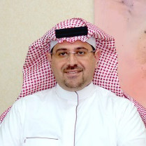
Mohammad Jarjaish Anjum


University of Engineering and Technology, Lahore

Tell me more about Mohammad Jarjaish Anjum?
Mohammad Jarjaish Anjum is a highly skilled professional with 14.6 years of experience in various fields such as mapserver, geoserver, quantum gis, geology, and Arcinfo. He is based in Saudi Arabia and has expertise in KSA, including AHCEC job task, laser scanning project completion, and Trimble Realworks. He has worked on mega projects, including the Medina drone project and the MDA, and has extensive experience in GIS and mobile mapping. Mohammad has also worked on international organizations such as the US Department of Defense and the Ministry of Interior.
For inquiries about Phone Number and Email, please click here Unlock Contact
Emails and Phone Numbers
About
KSA Expertise: AHCEC Job Task: Medina drone project (MDA) finalize within 33 days - Bentley context capture Medina Haram laser scanning project 1000 TX8 stations, processed in 14 days - Trimble Realworks 10.4 Aser Najran 2 years SEC GIS Mobile mapping project... MX9 IPS2 MX7 - POSPac Trimble business center OrbitGT Geoclean Magnet JATCO Job Task: GIS, 3D scanning & Mobile Mapping Consultant in KSA (5 Years International Exp) • Deliver GIS and Mobile Mapping training and provide solutions to clients on mega projects Client Name Includes (Aramco, MOMRA, Ministry of Interior, Ministry of Transport, SCECO, Military Survey Department, General Commission for Survey, Royal Commission of Yanbu and Jubail, Dar Al-Riyadh, MOWE - Ministry of Water and Electricity, RGF Survey company, ESRI Saudi Arabia, SBG, Schlumberger, JACOBS, many more contracting companies) Centimeter level accuracy of Trimble and ESRI products. • TRIMBLE: KSA Sale & marketing of Geospatial (land survey, GPS, Total Station), GIS, 3D Laser Scanning, Land Mobile Mapping Systems, Infrastructure VRS Network, Real-Time Correction System (more than 1,500 clients in KSA). Pakistan Projects: MEGA Projects (Each Project Cost in Millions) • GIS Manager Feasibility study of two Mega Metro-Train Projects Multan & Faisalabad • Master Planning and detailed designing of LDA City Lahore • Urban Transport Master Plan (LUTMP) 2030 • Deliver Training and Prepared Disaster Risk Management Plan (6 Years Exp) • USAID Pakistan Power Distribution Program (PDP) 2030 • Worked on Projects of International organizations (Trimble, JICA, World Bank, Asian Development Bank, USAID, National Disaster Management Authority) REPORT PUBLISHED: HR & Customer Satisfaction Survey of Excise&Taxation Department Government of Punjab http://www.punjab-prmp.gov.pk/dl.php?f=hr_and_customer_satisfaction.pdf Best regards: Mohammed Jarjaish GIS/GeoSpatial Consultant Cell: +966 572259215 (Cell) Email: [email protected] Skype: jarjaish
...See MoreWork Experience
gis team leader @isec | fme & fme server certified professional | mobile mapping-mtls | hds-3d lidar scanning | survey | aerial imaging | drone-bentley processing | orbitgt | 14 years exp | jarjaish@gmail com |
Mohammad Jarjaish Anjum's Professional Milestones
- Geographic Information System Team Leader (2019-11-01~): Transformed the GIS team into a strategic, efficient and highly motivated team.
- Information Management Officer- Gis Consultant (2011-12-01~2013-12-01): Implementing data-driven strategies to optimize organizational efficiency and drive data-driven decision making.
Education

Gis Remote Sensing
2010-2010Skill
Mapserver
Geoserver
Quantum Gis
Geology
Arcinfo
Erdas Imagine
Geomatics
Esri
Global Mapper
Data Management
Global Positioning System
Cartography
Spatial Analysis
Arcview
Spatial Databases
Data Collection
Remote Sensing
Gps
Geographic Information Systems
Arcobjects
Arcgis
Postgis
Arcsde
Field Testing
Gis Software
Gis
Google Earth
Lidar
Arcmap
Envi
Gis Application
Surveying
Gml
Google Maps
Digital Mapping
Arccatalog
Mapinfo
Gis Analysis
Database Admin
Wfs
Geoprocessing
Arcgis Server
Certification

Colleagues

Ala Abdulhadi
Executive Director

Abdulkader Adie
Project Supervision Manager

Khattab Ayyad
Director Project Delivery Services & Operations

Mohamed Abbas, M.Sc., PMP®, PMO-CP®
General Manager
Majdi Banna
Senior Director Geographic Information System & Geomatics
Other Named Mohammad Jarjaish Anjum
Frequently asked questions
We found 1 Mohammad Jarjaish Anjum's email addresses
Mohammad Jarjaish Anjum works for Integrated Services Engineering Consulting Company (ISEC)
Mohammad Jarjaish Anjum's role in Integrated Services Engineering Consulting Company (ISEC) is gis team leader @isec | fme & fme server certified professional | mobile mapping-mtls | hds-3d lidar scanning | survey | aerial imaging | drone-bentley processing | orbitgt | 14 years exp | jarjaish@gmail com |
Mohammad Jarjaish Anjum's colleagues are Ala Abdulhadi,Abdulkader Adie,Khattab Ayyad
Mohammad Jarjaish Anjum's latest job experience is gis team leader @isec | fme & fme server certified professional | mobile mapping-mtls | hds-3d lidar scanning | survey | aerial imaging | drone-bentley processing | orbitgt | 14 years exp | jarjaish@gmail com | at Integrated Services Engineering Consulting Company (ISEC)
Mohammad Jarjaish Anjum's latest education in University of Engineering and Technology, Lahore


